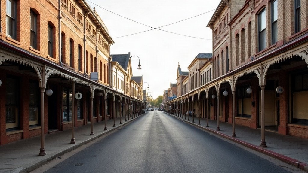
Ipswich is the council area run by Ipswich City Council, covering 1,093.9 km² with an estimated 268,272 residents. Council calls it “Queensland’s oldest provincial city”, and it pairs a heritage city centre with fast-growing suburbs such as Ripley.
Ipswich at a glance
| Topic | Ipswich |
|---|---|
| Council | Ipswich City Council (ipswich.qld.gov.au) |
| Population | 268,272 (ABS preliminary estimate, 30 June 2025) |
| Area | 1,093.9 km² |
| Main centres | Ipswich, Springfield Central, Ripley, Redbank Plains, Goodna |
| Hospital and Health Service | West Moreton Health |
The population figure is the ABS preliminary estimate at 30 June 2025, from Regional population 2024-25, released 31 March 2026. It is up from a revised 259,134 a year earlier, which is growth of 3.5%. Council’s divisional boundaries page lists suburbs including Booval, Bundamba, Springfield Lakes, Brassall, Karalee and Rosewood. To compare Ipswich with its neighbours, see our council areas overview.
Rates, bins and council services in Ipswich
Ipswich rate notices are issued quarterly.
Households get kerbside general waste, recycling and GO (garden organics) bins. Council says the GO bin “is part of the standard kerbside collection service for all customers” and is included in the waste charge, while units are assessed case by case. Collection days are on council’s address-based bin calendar, found through the waste and recycling pages.
To report an issue, use the Snap Send Solve app or council’s online form. For urgent issues, council’s number is (07) 3810 6666, 24/7.
Ipswich Libraries has seven listed locations, including Ipswich Central, Springfield Central, Rosewood, Redbank Plains and a self-service pod at Karalee. Council says “Joining the library is free”.
Hospitals and health care in Ipswich
West Moreton Health serves more than 320,000 people in Ipswich City, Scenic Rim, Lockyer Valley and Somerset.
Ipswich Hospital on Chelmsford Avenue provides 24 hour emergency care, maternity, surgery, paediatrics and mental health services. Its expansion is due in 2028, with 200 new overnight beds and a new emergency department.
Mater Hospital Springfield, at 30 Health Care Drive in Springfield Central, is a public hospital. It was officially opened on 20 May 2026 as “Queensland’s newest public hospital”, with 186 beds. It is separate from Mater Private Hospital Springfield, which is the private hospital.
For minor injuries and illnesses, the Ripley Satellite Health Centre at 150 Botany Drive, South Ripley, is open 8am to 10pm daily.
Schools, TAFE and universities in Ipswich
For state schools, start with EdMap, which the Queensland Government’s school catchment page links to. The government also keeps a schools directory.
TAFE Queensland’s Ipswich campus is on the corner of Mary and Byrne Streets in Bundamba.
UniSQ has two campuses in the city. UniSQ Ipswich, at 11 Salisbury Road, has a “particular focus on health and community degrees”. UniSQ Springfield, at 37 Sinnathamby Boulevard in Springfield Central, has a flight simulator, engineering labs and a media centre.
Getting around Ipswich
Two train lines serve Ipswich. The T1 Ipswich/Rosewood line stops at stations including Goodna, Redbank, Bundamba, Booval, Ipswich and Rosewood. The T2 Springfield Central line runs from Springfield Central through Springfield, Richlands and Darra to the city.
Fares are a flat 50 cents “across all Translink services, regardless of how far you travel”, with Airtrain excluded, according to Translink. The 50 cent fare became permanent from 10 February 2025. The Ipswich to Springfield rail corridor is at the planning stage only, with no build date.
For driving, the Department of Transport and Main Roads describes the Centenary Motorway, which serves Springfield, as the main link between Ipswich and the Brisbane CBD. On the Ipswich Motorway, Stage 1 of the Rocklea to Darra upgrade finished in 2021, and TMR’s page, last updated May 2024, lists the later stages as in planning. The Warrego Highway is the principal east-west freight route linking Ipswich and Toowoomba, and a Dinmore to Mutdapilly upgrade of the Cunningham Highway is in planning.
What living in Ipswich is like
Council counts more than 6,000 heritage-listed sites across the city on its Explore Ipswich page.
Parts of Ipswich are among the fastest-growing areas in Queensland. In the ABS Regional population release, the Ripley area grew by 3,100 people, a growth rate of 15%, and had the largest net internal migration gain in Queensland at 2,700. The Redbank Plains area had the state’s largest natural increase, at 460. At the 2021 Census, the median age in Ipswich was 33.
Parts of Ipswich have flooded before. Council records flood peaks of 20.7m in 1974, 19.4m at the David Trumpy Bridge in 2011 and 16.7m in February 2022. Its historical map shows the estimated extent of all three floods, though it does not change the planning flood lines. Check the flood map before you buy or rent: council’s Ipswich flood map lets you look up an address.
Once you have settled on a suburb, our Brisbane trades directory can help with the jobs that come with a new home, and our guide to what it costs to move to Brisbane covers the budget side.
Useful Ipswich links
- Waste and recycling: bins, the GO bin and your bin calendar.
- Report an issue: telling council about a problem.
- Ipswich flood map: checking flood risk for an address.
- Ipswich disaster dashboard: council’s disaster information.
- Ipswich Hospital: services and location.
- EdMap: the school map linked from the Queensland Government’s catchment page.
- Translink fares: tickets and the 50 cent fare.
Sources
- ABS, Regional population 2024-25: population and area data and the release summary, released 31 March 2026.
- ABS 2021 Census QuickStats: Ipswich local government area.
- Ipswich City Council: garden organics, libraries and historical flood mapping.
- West Moreton Health: Ipswich Hospital.
- Queensland Government: Mater Hospital Springfield opening statement.
- Translink: tickets and fares.
- Department of Transport and Main Roads: Centenary Motorway upgrade planning.
Facts on this page were checked on 16 October 2026.