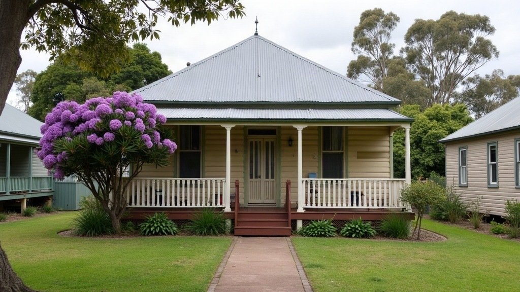
Living in Ipswich means choosing between two quite different places inside one council area. Ipswich City Council calls it Queensland’s oldest provincial city, with more than 6000 heritage-listed sites, and puts it about 40 minutes’ drive from Brisbane. The same council area also takes in Springfield and Ripley, and the ABS names Ripley as the area with the largest population growth in Queensland.
Every number below links to the official page it came from. For council contacts, start with our Ipswich council area page.
Who lives in Ipswich?
At the 2021 Census, the Australian Bureau of Statistics counted 229,208 people in the Ipswich local government area, with a median age of 33. The same page puts the Queensland median at 38, so Ipswich is younger than the state as a whole.
The same Census page has a few more figures worth knowing before a move:
- Households: the average household had 2.8 people.
- Cars: the average dwelling had 1.9 motor vehicles.
- Rent: median weekly rent was $330 in 2021.
- Income: median weekly household income was $1,668.
- Birthplace: 72.9 percent of residents were born in Australia and 5.3 percent in New Zealand.
These are 2021 figures, so the $330 is a historical marker and not what you will pay today. Our renting guide explains how bonds and leases work in Queensland.
Ipswich suburbs: the heritage centre and the new estates
The council groups its suburbs into four divisions on its divisional boundaries page, and that page is a handy way to see how the city is laid out.
- Central Ipswich: Division 3 follows Brisbane Road and the Ipswich train line, and includes Ipswich, Booval, Bundamba, Newtown, Woodend and Sadliers Crossing.
- Springfield: Division 2, at the eastern end, includes Springfield, Springfield Central, Springfield Lakes, Augustine Heights, Brookwater and Goodna.
- Ripley and the south: Division 1 includes Ripley, South Ripley, Deebing Heights, Redbank Plains and Raceview.
- North and west: Division 4 mixes rural and urban suburbs, including Brassall, Karalee, Yamanto, Walloon and Rosewood.
How fast are the new estates growing? In its regional population release for the year to June 2025, the ABS says Ripley added 3,100 people, the largest growth of any area in Queensland. Its growth rate of 15 percent was the equal highest in the state. Ripley also had the state’s largest net gain from people moving within Australia, at 2,700. Redbank Plains had the largest natural increase, at 460 people.
What do Ipswich rates and bins look like?
Ipswich City Council issues rate notices quarterly. Each notice shows a discount expiry date and a due date, and the council says payment has to arrive on or before the discount expiry date to get the discount. You can register to receive notices by email.
Most houses get three bins. The council’s general waste page sets out the service:
- General waste, red lid: a 240 litre bin collected every week.
- Recycling, yellow lid: a 240 litre or 360 litre bin collected every second week.
- Garden organics, green lid: a 240 litre bin collected on the alternate fortnight to recycling.
The waste charges appear on your quarterly rates notice. The council’s garden organics page says standalone houses are eligible for the green lid bin, while apartments, units and some townhouses do not get one automatically and are assessed case by case. To find your collection day, the council points residents to its free Ipswich Bin App or its 12 month collection calendar.
How do you check flood history in Ipswich?
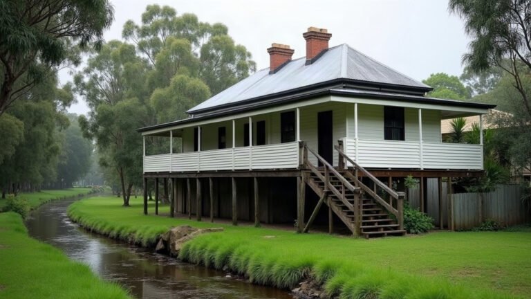
Check before you sign anything, because parts of Ipswich have flooded more than once. A council statement from May 2023 gives the peak of each of the city’s three major floods:
- 1974: 20.7 metres.
- 2011: 19.4 metres at the David Trumpy Bridge.
- February 2022: 16.7 metres.
The council’s historical flood mapping tool shows the estimated extent of all three floods across the whole council area, along with data for individual properties. The council says the tool does not change the flood lines it uses for planning, so treat it as history and ask about the planning scheme overlay as well.
Our flood check guide explains what to look for in a flood report and which questions to ask the agent and your insurer.
Getting around Ipswich by train and car
Two train lines serve the Ipswich council area. Queensland Rail’s network map lists them:
- Ipswich and Rosewood line: from Darra the line runs through Wacol, Gailes, Goodna, Redbank, Riverview, Dinmore, Ebbw Vale, Bundamba, Booval and East Ipswich to Ipswich, then on to Thomas Street, Wulkuraka, Karrabin, Walloon, Thagoona and Rosewood.
- Springfield Central line: this branches off at Darra and runs through Richlands to Springfield and Springfield Central.
The map lists no station at Ripley.
Translink says fares are a flat 50 cents across all Translink services, no matter how far you travel. Our public transport guide covers go cards and how the network fits together. The 2021 Census counted an average of 1.9 motor vehicles per dwelling in Ipswich, so budget for running a car as well.
Health, study and libraries in Ipswich
Queensland Health and Mater list these services in the Ipswich council area:
- Ipswich Hospital: Queensland Health lists the emergency department on Chelmsford Avenue as open 24 hours, every day of the year.
- Ripley Satellite Health Centre: the minor injury and illness clinic at 150 Botany Drive, South Ripley, is open 8am to 10pm, seven days a week.
- Mater Hospital Springfield: Mater describes it as the Springfield community’s first public hospital.
See also our guide to finding a GP and hospital.
The University of Southern Queensland has two campuses in the council area. UniSQ Ipswich says it has a particular focus on health and community degrees. UniSQ Springfield, at 37 Sinnathamby Boulevard in Springfield Central, lists 125 degrees. Joining Ipswich Libraries is free, and the council lists branches including Ipswich Central, Springfield Central, Redbank Plains and Rosewood.
Is living in Ipswich right for you?
Ipswich suits you if you want a house near a station, or a new house in an estate and you are happy to drive. It may suit you less if you want a train at the end of the street in Ripley, or if a street that flooded in 1974, 2011 or 2022 would put you off.
Before you commit, do three things. Look up the address on the council’s flood mapping tool. Check which train line, if any, is close. And drive the commute at peak hour at least once.
Sources for this Ipswich guide
- Ipswich City Council: Explore Ipswich, Divisional boundaries, Rates, General waste, Garden organics, Historical flood mapping statement, Flood mapping tool, Ipswich Libraries.
- Australian Bureau of Statistics: 2021 Census QuickStats, Ipswich, Regional population, latest release.
- Queensland Rail: Text version of the SEQ network map.
- Translink: Tickets and fares.
- Queensland Health: Ipswich Hospital, Ripley Satellite Health Centre.
- Mater: Mater Hospital Springfield.
- University of Southern Queensland: UniSQ Ipswich, UniSQ Springfield.
Facts on this page were checked on 12 November 2026.